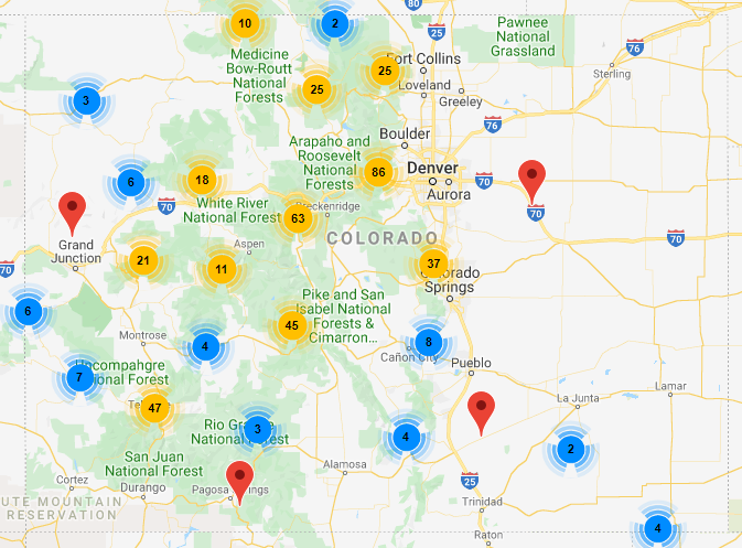
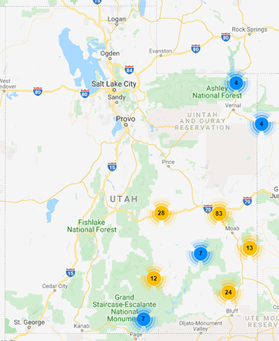
Search
 
TrailDamage.com Logo
HomeTrailsMembersCalendar of EventsStuff!

Rose Garden Hill
Grand County, Utah
View this on the Utah Trailheads Map

Nearby Towns: Moab
Nearby Trails: Onion Creek, Top Of The World, Dome Plateau, Dolores River, Pole Canyon Rim, Cottonwood Canyon
Trail Length: 18.9 miles
Elevation: 4,107 to 6,345 feet

Rose Garden Hill is the single obstacle on this trail and it gives the trail its name. It is a long, rocky and challenging hill that will turn away many stock 4x4 vehicles. It is especially difficult for dirt bikes and bicycles.

The trail starts from the Onion Creek trail at the sign for the Kokopelli Trail. This popular and very long bike trail also shares most of the Rose Garden Hill trail, so you will often find bicycles on the trail. The Top of the World trail also connects to Rose Garden Hill near the other end.

It starts off as a fairly mellow trail, though it is slightly more rocky than the Onion Creek trail from the very start. You wind your way through the trees and soon you come to a rocky shelf that you drop down as you start your descent into Cottonwood Canyon. At this point you can look across the canyon to see Rose Garden Hill.

There is a parking area at the base of the hill. The roughest part of the hill is at the top, but it starts off rocky at the bottom. Most of the big rocks at the bottom are avoidable.

When you get close to the top there are ledges and rocky sections that you must work your way through, with a ledge at the very top. You may have some clearance issues if you have a stock vehicle.

Once past the hill the trail is fairly mellow again, with a narrow area that has a ledge that must be crossed. There are some brief sections of shelf road, as well.

Member Reports

Driving Directions

From Moab, drive north to the turn off for Highway 128 that is just south of the Colorado River bridge on the north end of town. This is the same road that comes from the Cisco exit off of I-70. Take this highway for 20.2 miles until you see the sign for Onion Creek in the wide open area of the Richardson Ampitheater. Follow this trail for 8.9 miles and turn left at the Kokopelli Trail sign. This is also the trailhead for Rose Garden Hill.

Meeting Places

Meet at the McDonald's at Kane Creek Road and Main Street in Moab.

Low-End Rating: 3
High-End Rating: 4
Rock Crawling:
Dirt & Mud:
Water Crossings:
Playgrounds:
Cliffs & Ledges:
Climbs & Descents:
Elevation:
Scenery:
Other Activities:
 
What does this mean?

Trail Photographs

Big View Rose Garden Hill Shelf Road

Maps and Coodinates
(Click a map to view full size)

Trail in Red with Onion Creek in Blue and Top Of The World in Purple
700 x 600 pixels
307 KB
Trail in Red
900 x 1000 pixels
663 KB

Rose Garden Hill (GPS Exchange File)
Rose Garden Hill (Google Earth Placemark)
Rose Garden Hill Track (Google Earth Track)
Rose Garden Hill Trailhead (Google Earth Placemark)

Copyright © 2002-2010  |   About TrailDamage.com  |   Terms Of Service  |   Contact Us  |   Member Log In  |   RSSRSS
 
Trail information is only accurate on the date posted. Trails may have changed or closed since that date. Use this information for historical purposes only. Contact the Forest Service or Bureau of Land Management for up-to-date trail information.

Designed by Glowball Solutions, Glowball.com